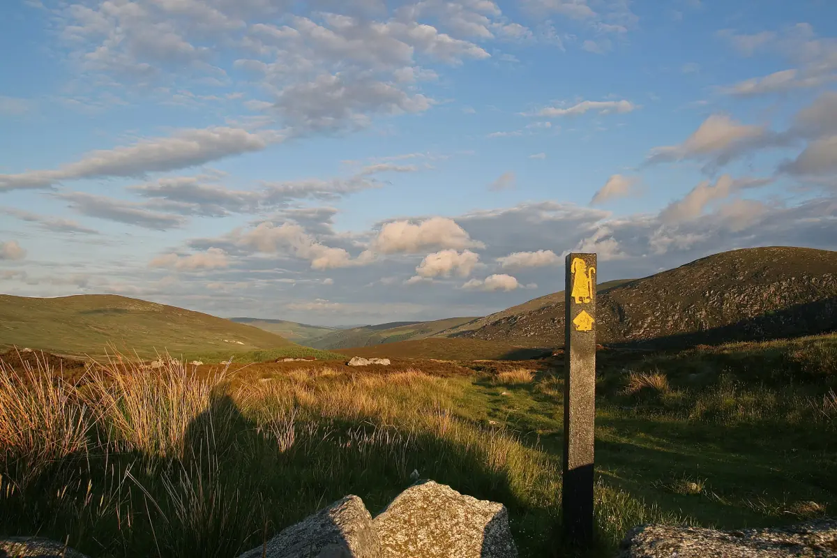
Wicklow Way route and demands
The Wicklow Way runs for 128.1 km from Marlay Park in Rathfarnham to Clonegal. Sport Ireland classifies the trail as strenuous. This makes it a route to plan as a walking project, with accommodation and transport considered alongside time on the trail. The full route and a local day walk serve different purposes; choose between them before comparing the practical arrangements.
Its surfaces include forest roads, quiet roads, narrow country lanes and mountain paths. Some sections can be wet or muddy. Yellow arrows on a black background mark the route. The mixture of surfaces matters when preparing a daily plan: a distance on paper is only one part of the effort. Think about the type of ground, the weather and the connection to the place where you intend to stop.

Six stages as a planning model
The published tourism model divides the walk into Marlay Park to Knockree, Knockree to Roundwood, Roundwood to Glendalough, Glendalough to Glenmalure, Glenmalure to Tinahely, and Tinahely via Shillelagh to Clonegal. This is a six-stage framework rather than an obligation to finish each section in one day. Use the named places to understand the sequence, then adapt the walking programme to the party.
Accommodation frequently lies away from the route. A stage therefore ends with more than the final trail marker: the journey to the overnight stop may be a separate part of the day. Before settling the itinerary, match the accommodation address with the intended trail exit. The guide to Wicklow bases explains the difference between a general regional base and a place selected for a walking stage.
A local valley walk
This walk from Laragh offers a local walking alternative in the area.
Hand-picked tours, booked through Viator. Prices are indicative starting prices in euros (as of October 2026). Tap a tour for live availability and the current price in your currency.

A local valley walk from Laragh
Consider the 300-minute valley outing as a day alternative to the long-distance trail, with parking and toilets among its listed inclusions.
Wicklow Mountains hiking as a day alternative
Wicklow Mountains hiking can also mean a local outing rather than a full traverse. The valley walk featured here begins in Laragh and is listed as 300 minutes. Its starting instructions point to the village car park beyond the sports pitch, with the meeting point at the information signs on the right. Choose this format if the aim is a single local walking day.
The listed inclusions are free parking and toilets at the start and midway point. Build your arrival plan around Laragh rather than a Dublin pickup. Keep this local activity separate from the long-distance route: a booked valley outing covers that outing, while a Wicklow Way itinerary needs its own sequence of stages and overnight connections. The national park guide provides the broader setting for a day in the mountains.
Transport to the start and from the finish
A linear route requires a plan for both ends. Marlay Park is the northern starting point, while Clonegal is the southern end of the full trail. For a shorter section, identify the actual point where you intend to leave the route before choosing onward travel. Reaching a village elsewhere in the county is not the same as reaching that day’s trailhead.
Laragh and Roundwood lie on the Glendalough bus connection. Local Link 183 links Arklow, Avoca, Rathdrum, Wicklow Town, Roundwood, Laragh and Glendalough; route 895 connects Glendalough with Blessington and Sallins. These corridors help frame possible connections, but a walking schedule must fit the relevant journey. See getting to and around Wicklow before combining a stage with public transport.
Ground conditions and time outdoors
Wet and muddy sections deserve room in the plan. Choose the distance with the people walking it in mind rather than copying the six-stage model as a fixed target. Leave time for the link from the trail to accommodation and for the following morning’s return to the route. These connections are particularly important when the overnight address is away from the marked way.
The seasonal guide helps separate weather planning from the opening hours of individual visitor attractions. Mountain lakes and rivers also require caution: the national park’s notice of 23 June 2026 warns of cold shock, currents and sudden depth changes. A walking break beside water should not become an unplanned swim. Make the walking route and its return arrangements the centre of the day.
Glendalough along the route
Glendalough is a stage location and a cultural destination in its own right. For the medieval site, use the dedicated Glendalough guide. Keep cultural visiting time distinct from the demands of the day’s walking section.
Questions about your visit
How long is the Wicklow Way?
The full linear route is 128.1 km from Marlay Park in Rathfarnham to Clonegal. It is classified as strenuous.
Must it be completed in six days?
The six-stage framework is a planning model. Adapt daily distances to the walkers, conditions and the location of overnight accommodation.
Does the valley outing cover the entire trail?
The featured activity is a local valley walk starting in Laragh. Plan a full Wicklow Way journey separately, including every stage and overnight connection.
What waymarks should I look for?
The route uses yellow arrows on a black background. Its surfaces include forest roads, quiet roads, country lanes and mountain paths, with some wet or muddy sections.